Summit Series

The Bolton Trails Committee: Summit Series
A self-guided challenge to climb all of the “mountains” in Bolton, MA
The Town of Bolton is what it is today because of the topography of the region, shaped by the glaciers over 12,000 years ago. Many of our roads were historical paths used to avoid the hilly areas throughout town. Some were Native American routes, like present day Main Street, to avoid present day Wattaquadock Hill, Long Hill, and Powder House Hill. Still River Road, also an ancient Native American route, followed along the side of Vaughn Hill. The path of Interstate 495 was likely chosen because it bypassed many of the hills in the area, including Pine Hill, Rattlesnake Hill, Spectacle Hill, Powder House Hill, and Wattaquadock Hill.
As referenced in Esther Whitcomb’s About Bolton, Whitney’s History of Worcester County describes Bolton’s topography in 1793:
The town in general is good land, not level, nor yet has it any very high hills . . . . It is not very rocky, however there are stones sufficient to wall in all their farms.
With Bolton being located in more of a hilly upland area without a major river going through town (other than the very small section of the Nashua river in the Northwest corner), the town was not conducive to having a large mill or shipping port. This lack of a major water source resulted in a less densely populated area more devoted to farming than industry.
If you have looked at a topographic map of Bolton, or run or pedaled through the area, you know that there are quite a few pronounced hills throughout town. Conveniently, many of these hills are on publicly accessible conservation areas with trails leading to the tops of these hills.
The Bolton Trails Committee, the Bolton Conservation Commission, and the Bolton Conservation Trust are encouraging the residents of Bolton and surrounding communities to get outside and explore some of our local conservation area hills.
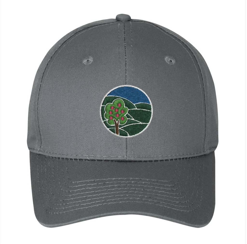
The Bolton Conservation Trust is sponsoring a challenge for those who “summit” these hills in the 2023 Summit Series. This challenge requires the participants to reach the summit of seven of our hills, starting at designated trail heads. Those who participate in this challenge, and fill out the Official Form, can earn a limited-edition hat as a token of appreciation. The hats are available in both youth and adult sizes. Please reference the Official Guide created for this challenge to identify the summits and starting locations.
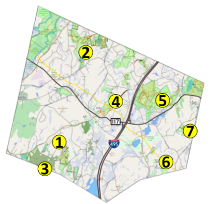
| No. | Name of Hill | Conservation Area | Start Description | Hill Elevation, feet | Approximate Distance to Summit (one way), miles |
| 1 | Watttaquadock Hill* | Welch Pond | Welch Pond Trail Head, Wattaquadock Hill Rd. | 640 | 0.6 |
| 2 | North Peak | Vaughn Hills | Moen Parking Area, Vaughn Hill Rd. | 633 | 1.0 |
| 3 | Peach Hill** | Fyfeshire | Fyfeshire Gate, Wattaquadock Hill Rd. | 555 | 0.8 |
| 4 | Powder House Hill | Powder House | Town Common, Main St. | 551 | 1.0 |
| 5 | Rattlesnake Hill | Rattlesnake | Lime Kiln Trail Head, Main St. | 479 | 1.0 |
| 6 | Barrett’s Hill | Danforth | Danforth Trail Head, Danforth Ln. | 472 | 0.6 |
| 7 | Long Hill*** | Annie Moore | Annie Moore Trailhead, Bolton Woods Way | 442 | 1.5 |
Notes:
Other notable hills in town were excluded from this challenge mainly due to lack of public access
*The summit of Wattaquadock Hill is on private land. Finding the high point near the existing trail, near the old foundation for the lookout tower, will count as credit for the Summit Challenge.
**The summit for Peach Hill is on private land in Berlin, MA. Completing the journey along the trail from Fyfeshire Conservation Area to the end of Peach Hill Rd. will count as credit for the Summit Challenge.
***The summit for Long Hill is on private land off Annie Moore Rd. Completing the journey along the trail from the Bolton Woods Way Trail Head to the Parking Area/Trail Head off of Annie Moore Rd. will count as credit for the Summit Challenge.


Youth and Adult Sizes
Thank you to Natalie MacKnight of MacKnight Design for the design of the hats and logo


