Use your Smartphone to find your route
Using a smartphone should be considered to be an addition to conventional maps. There is no substitute for good navigation and basic outdoor skills when exploring Bolton Trails.
Bolton Trails Committee has made available gps files for you to use as an aid to following paths in Town. Trail users have found them very useful, but making sense of them is not always obvious and you might need to load additional apps on to your mobile device, or you might want to set things up on a computer and then transfer the files to your smartphone before you set out on your hike.
For security reasons, these files are in kmz format. “kmz” is a way of storing routes. It is a useful format because is less prone to virus infection than other gps file types like gpx and kml.
If necessary, you can convert kmz to kml using the “File->Save ->Save Place As” feature on Google Earth, but for most purposes you can use the files directly as outlined below.
In order to use the kmz files, you will need a smartphone or tablet with gps and internet access. You will also need an app that can read gps files. The most common is Google Maps and it’s free, but there are others and they can have a subscription fee, a one-off license cost, or have in-app ads and purchases, but in general are easier to use. Some apps will allow you to record and save your route for future use.
To find a suitable app, go to the Apple App store or Google Play Store, search for “.kmz” and take your pick of the options. There are many!
Note Trails can change – maps and .kmz files will be updated as time goes on. If you have used .kmz in the past, we recommend that you remove any old .kmz files and load new ones before starting out on your hike.
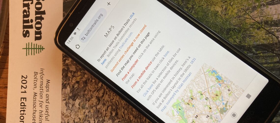
- Find the online map of the area that interests you from the Boltontrails.org home page.
- Download the kmz file. by clicking on this icon:

- It will have a name like Taggart_KMZ.kmz.
- Alternatively, you can access all of Bolton Trails Committee’s .kmz files from here: https://boltontrails.org/GPS-Files
If you are using a Google maps, follow the instructions below. A computer makes things easier to set this up. If you are using a third party app follow the instructions provided; in that case you may just need to click on the file and the .kmz will be loaded on to a Bolton map automatically.
- You will need a Google account in order to use this technique.
- On the computer, go to “mymaps.google.com”.
- Click “CREATE A NEW MAP”

- You should see this message; click “CREATE”.

- You will the see a map like this:

- Give the map an appropriate name such as “Boltontrail”. Add a description if you like.
- Click “Save”.

- Now click on the word “Import” and browse to find your .kmz file.
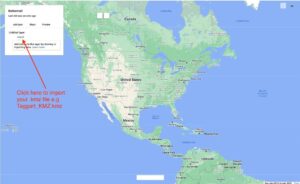

- Immediately after importing the .kmz, your trail map will appear. In this example it’s the Taggart area. The thin black lines show the trail route.

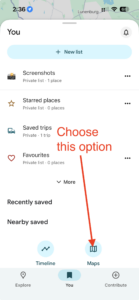
- Next, make sure that you are logged on to Google. Then open Google maps on your smartphone or tablet (Android or Apple), and click on the “You” option:
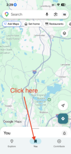
- You will see this screen, select “Maps”:
- Your trail map will appear on the list.

- Select it and it will be available for you to use and track your position as you hike with your iPhone or Android device..