Map Updates
December 31, 2019
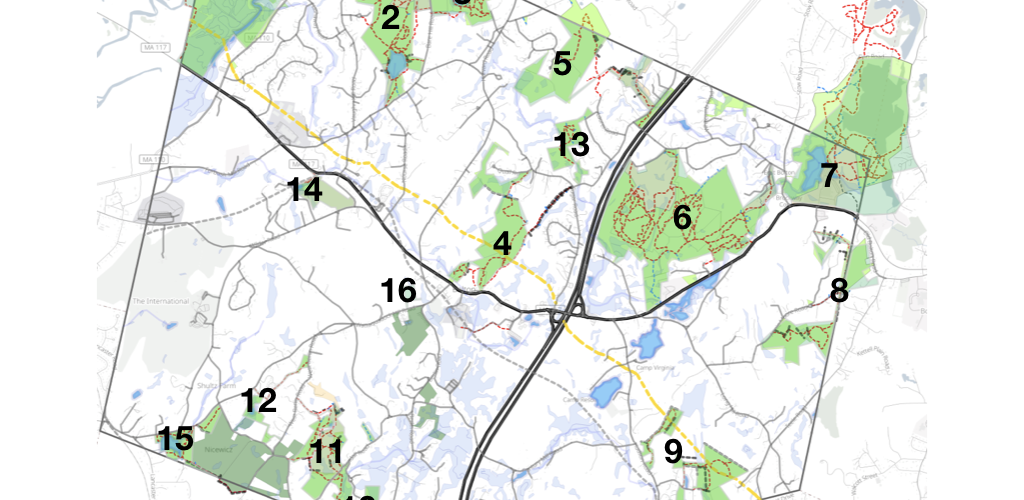
New maps for the New Year!
- The Rattlesnake Hill and Vicinity map has been completely re vamped with updated trails including the Sawyer Grist Mill section. There is more information about the industrial archeology to be found in the area such as the Lime Kiln. the Quarries and the Philo Clapp Pump Mill. The maps has been split into subsections for North West, South West, East and Bob Horton Areas. Subsection maps can be accessed by clicking from the area map. Rattlesnake Map
- The Powder Hill and Town Center map has been replaced with a new version: Powder House Map
- All of the 2019 versions of the maps have been updated to make the public roads clearer. These are Vaughn Hills, Powder House, Fyfeshire/Haynes-Wheeler, Zink-Northwoods, Annie Moore and Danforth Brook/Keyes Farm
- Finally a townwide trail map is available. It uses the same base as the all of the other trail maps in town. Town-Wide Trail Map