MassMapper Adds Lidar Layer to Show Topography
January 20, 2024
MassGIS, the Beaureau of Geography Information released a new Lidar layer to visualize the topography of land within Massachusetts without area.
What is Lidar? Light Detection and Ranging, a technology used to create high-resolution models of ground elevation with a vertical accuracy of ~4 inches.
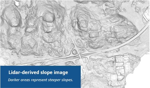
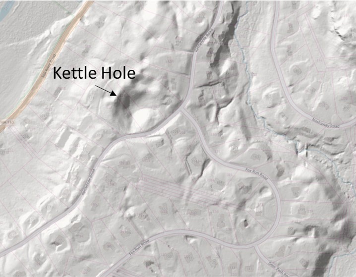
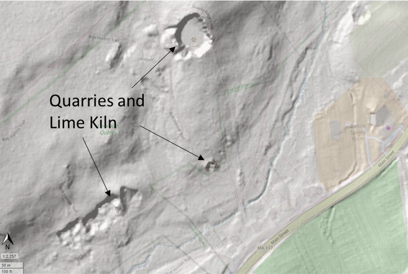
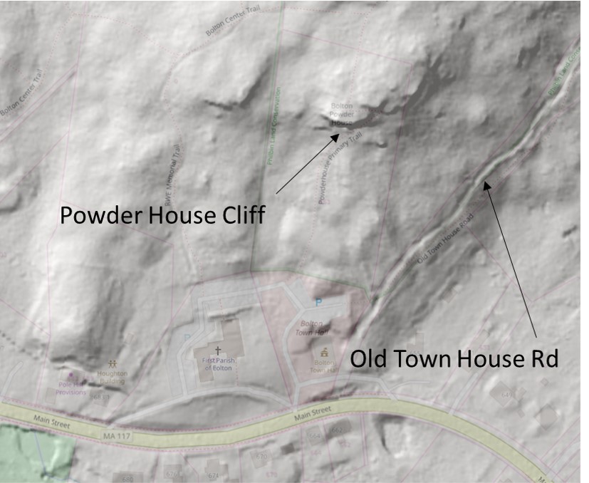
Why should I care? Well, your taxes went to pay for it AND you can now visualize some interesting features in town on the map like cliffs, boulders, quarries, trails, and even stone walls. See some examples below.
How can I view it?
| 1 | Recommend using a computer or tablet, and go to the Mass Mapper Homepage https://maps.massgis.digital.mass.gov/MassMapper/MassMapper.html |
| 2 | Click on the magnifying glass in the top right 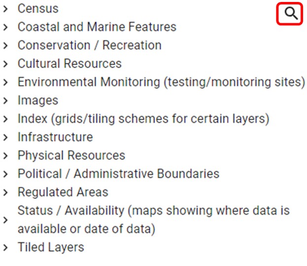 |
| 3 | Type “Shaded Relief from Lidar” and select the option below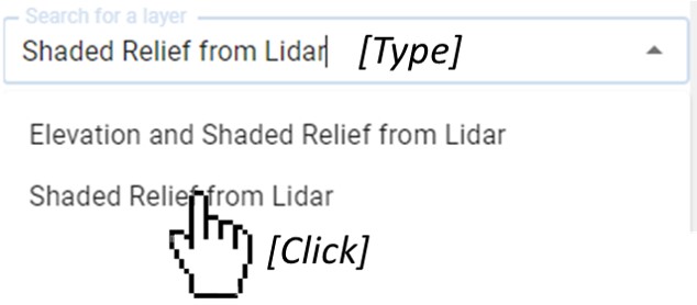 |
| 4 | Click the button next to the layer wording |
| 5 | Change the opacity of the Lidar layer to view the base map below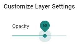 |
Let us know if you find something interesting when browsing through the Lidar layer. Feel free to email us (info@boltontrails.org) or leave a comment.