Taggart Connection to Sand Road now available
February 9, 2023
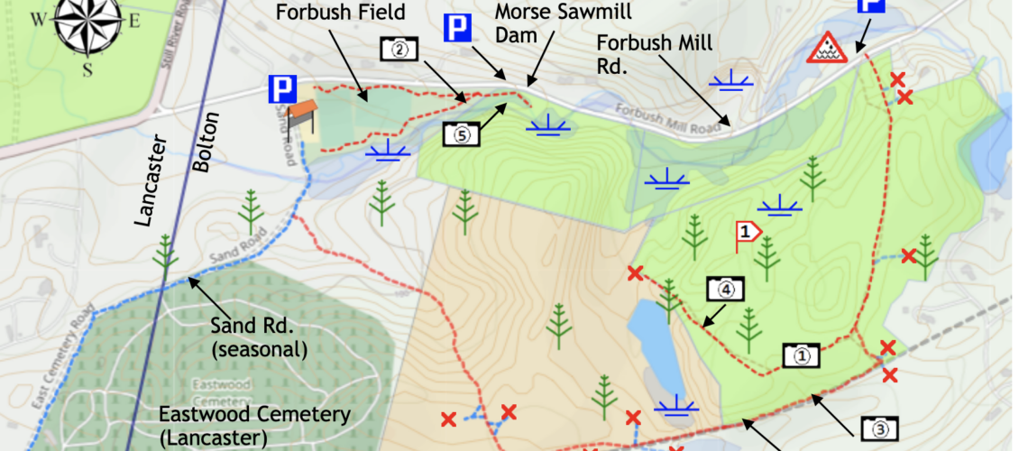
Walkers on the Taggart property will have noticed that that the old railway bed continued on to private land beyond the “End of Trail Sign”. This land is owned by the Vespa family and the trail continues across the area on to property associated with the Eastwood Cemetery which, although in Bolton, is actually operated by the Town of Lancaster.
The Vespa family and the Town of Lancaster have very generously given permission of for the public to use this path to Sand Road, forming a connection to the Forbush Road parking area and the soccer fields.
The maps have been updated and the route has been marked with arrows. The private property boundaries are now clearly noted on the path. The “End of Trail” sign has now been removed. The gps track in .kmz format available on boltontrails.org has also been updated.
You can download the map here
The gps file is available here
The gps file for all trails in Bolton is available here